Welcome to Alberta Construction Surveying
We are a multidisciplinary survey firm located in Edmonton, AB. Engineering construction layout has been at the heart of our company. We can help with anything survey related. With over 200 commercial projects completed from start to finish under our belt, you can be assured that each task we perform will be done to the best of our ability and in accordance with Alberta provincial standards. Underground stakeouts, curb and gutter, pilings, gridlines, anchor bolts, columns, it is all in our scope of work. All of our survey equipment is brand new and always operational. We use top of the line GPS and Total Stations combined with office software such as Civil3d, ArcGIS, Trimble Business Center and Leica Infinity to provide a fast, accurate and reliable layout. All of our layout is checked both in the field and digitally to eliminate the chance of any costly errors. Inaccurate surveys can be very costly. Bad site planning can be devastating to the budget of a construction project. Let us help you to ensure that you have everything in order to get your project headed in the right direction. Call us today for a free quote.

Construction Staking
Construction staking services ensure precise marking and layout, guaranteeing that projects are completed with accuracy and efficiency.

Geomatics
Delivering accurate data and mapping, geomatics services in Alberta help drive precise planning and execution for projects in various industries.

Drone and LiDAR
Our LiDAR and drone surveying in Alberta offers high-quality data capture, facilitating detailed terrain analysis for optimal planning and design.

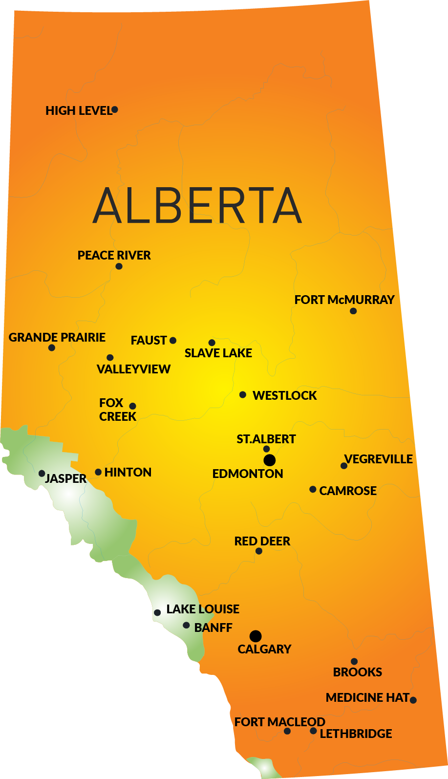
Our service locations.
We provide construction staking, geomatics and drone and LiDAR services throughout all of Alberta including:
Our service locations.
Alberta Construction Surveying provides construction staking, geomatics and drone and LiDAR services throughout all of Alberta including:
- Calgary
- Edmonton
- Fort McMurray
- Grande Prairie
- Jasper
- Hinton
- Peace River
- High Level
- Vegreville
- Banff
- Valleyview
- Westlock
Our Most Popular Services
HOW WE CAN HELP YOU ON YOUR CONSTRUCTION OR ENGINEERING PROJECT
Construction Surveyors
Offering construction surveys for all project stages, ensuring accurate site layouts, grading, and elevation measurements to meet project engineering specifications.
Drone and LiDAR
Providing advanced drone and LiDAR surveys, capturing detailed topographic data and 3D models for efficient planning, monitoring, and analysis of your project.
Geomatics and GIS
Specializing in geomatics and GIS services, delivering precise mapping, spatial data analysis, and accurate geographic insights for effective decision-making and project planning.
Over 20 Years Experience
Trusted by the largest engineering firms in Alberta…
Our surveying, geomatics, and drone services are trusted by Alberta’s leading engineering firms to deliver precision and reliability on every project. With cutting-edge technology and expertise, we provide accurate data and seamless solutions to meet your project’s needs.
Edmonton, Fort McMurray, Cold Lake, High Level


